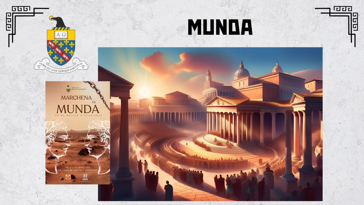
El Bellum Hispaniense Bajo la Lupa: Claves Textuales que Apuntan a Marchena
ART ESP / INGLES
A través de un meticuloso análisis textual del Bellum Hispaniense, esta investigación desentraña las descripciones topográficas, estratégicas y tácticas inherentes al relato del campo de batalla. Estas descripciones textuales se someten a una rigurosa comparación con las características geográficas y orográficas del entorno actual de Marchena, una localidad situada en la campiña sevillana. El resultado de esta confrontación revela una serie de coincidencias significativas que robustecen la hipótesis central de este estudio: que Marchena es, de hecho, la Munda mencionada en el Bellum Hispaniense y otras fuentes clásicas.
La argumentación a favor de esta identificación se construye sobre una base sólida que incluye la reinterpretación crítica de un epígrafe previamente examinado bajo otras perspectivas, así como un exhaustivo análisis de diversas fuentes grecolatinas que aluden al conflicto y a la geografía de la región. A esta base textual se suma la consideración de la evidencia historiográfica acumulada a lo largo de los siglos y los hallazgos arqueológicos dispersos en el área de Marchena y su influencia. La propuesta aquí presentada desafía las teorías previas que han situado Munda en otras localizaciones de la geografía andaluza, buscando ofrecer una nueva luz que esclarezca el pasado romano de Marchena y, por extensión, un episodio crucial de la historia de la Península Ibérica.
1. Introducción: Desentrañando el Enigma de Munda
La ubicación precisa de Munda, el enclave que presenció el enfrentamiento decisivo entre las fuerzas de Julio César y los hijos de Pompeyo Magno, Cneo y Sexto, en el año 45 a.C., ha representado un persistente foco de debate y controversia dentro de la historiografía romana y de la arqueología peninsular. El Bellum Hispaniense, documento primario que narra con detalle los acontecimientos de esta campaña final de César, ha sido tradicionalmente atribuido al propio líder romano, aunque una corriente crítica de autores sugiere una autoría anónima, posiblemente cercana a su círculo militar.
Sin embargo, el presente estudio no se detiene en la resolución del debate sobre la autoría del Bellum Hispaniense. Su objetivo principal radica en abordar el intrincado enigma de la identificación geográfica de la ciudad de Munda, un topónimo que ha eludido una localización definitiva hasta la fecha. La tesis central que se articula a lo largo de esta investigación postula que Marchena, una localidad con una rica historia y vestigios de ocupación romana, es en realidad la Munda a la que hacen referencia las fuentes clásicas. Para fundamentar esta conclusión, se establecen una serie de premisas basadas en extensas visitas de campo al área de estudio, permitiendo una comprensión directa del terreno, y una exhaustiva corroboración de las fuentes documentales disponibles, tanto textuales como materiales.
El estado actual de la cuestión revela un panorama fragmentado y lleno de incertidumbre respecto a la ubicación de Munda. A lo largo del tiempo, diversas teorías han propuesto localizaciones alternativas, extendiéndose por una amplia geografía andaluza. Entre estas propuestas destacan Monda (en la provincia de Málaga), Montilla (Córdoba), el yacimiento de Acinipo (también en Málaga), Ronda la Vieja (otra posible ubicación malagueña), la Sierra de Tolox (nuevamente en Málaga), los Llanos de Vanda (cercanos a Montilla, en Córdoba), el Cerro de la Atalaya (en el término municipal de Osuna, Sevilla), el Alto de las Camorras (también en Osuna) o incluso una ubicación entre los cerros de Las Balas y del Águila en Lantejuela, un territorio limítrofe entre Marchena y Écija. No obstante, se argumenta que la mayoría de estas propuestas adolecen de pruebas concluyentes y, en algunos casos, se ha demostrado que corresponden a otros núcleos de población romana con identidades históricas propias, como Acinipo, Urso o la importante colonia de Astigi (la actual Écija).
La batalla de Munda, según el testimonio de las fuentes antiguas, se libró el 17 de marzo del año 45 a.C. y culminó con una victoria crucial para las legiones de César sobre los últimos reductos del bando pompeyano liderados por los hijos del difunto Magno. Tras la contundente victoria cesariana, la ciudad de Munda sufrió las consecuencias de su apoyo a los pompeyanos, siendo arrasada y su población diezmada, con un saldo estimado de aproximadamente 20.000 muertos y la reducción a la esclavitud de los supervivientes.
Como escarmiento ejemplar, César prohibió expresamente la reconstrucción de Munda, mientras que mostró clemencia hacia otras ciudades de la región. Este hecho histórico habría conducido al progresivo abandono del sitio original de Munda y a una suerte de damnatio memoriae, permitiendo el desarrollo y la preeminencia de otros enclaves cercanos. La presente investigación sostiene que los vestigios de esta Munda devastada se encuentran en la actualidad en el subsuelo de Marchena y su entorno, en contraposición a las interpretaciones previas que la han buscado en otros puntos de la geografía andaluza.
2. Metodología: Un Enfoque Multidisciplinar para la Identificación de Munda
La metodología empleada en esta investigación se fundamenta en un enfoque multidisciplinar que busca integrar diversas líneas de evidencia para construir un argumento sólido y convincente. Este enfoque combina el análisis textual detallado del Bellum Hispaniense con la evaluación crítica de la evidencia arqueológica recuperada en la zona, el estudio de las inscripciones romanas (evidencia epigráfica) y la revisión de las fuentes historiográficas clásicas y modernas que abordan la cuestión de la ubicación de Munda.
- Análisis Textual del Bellum Hispaniense: Se lleva a cabo una lectura exhaustiva y minuciosa del texto del Bellum Hispaniense con el objetivo de identificar y extraer todas las descripciones de carácter geográfico, topográfico, estratégico y táctico que puedan estar relacionadas con la batalla de Munda y la ubicación de la ciudad. Se presta especial atención a la terminología utilizada para describir las características del terreno (llanuras, elevaciones, accidentes geográficos), las indicaciones de distancias entre puntos relevantes, las referencias a las formaciones militares empleadas durante la batalla y cualquier otro detalle que pueda ofrecer pistas sobre la configuración del campo de batalla y su entorno.
- Análisis Geográfico y Orográfico del Entorno de Marchena: Se realiza un estudio detallado de las características geográficas y orográficas del municipio de Marchena y su área de influencia. Esto incluye la identificación precisa de llanuras extensas, elevaciones significativas (cerros, colinas), la red hidrográfica (ríos, arroyos, fuentes), las antiguas y modernas vías de comunicación que atraviesan o se acercan a la zona, y otros elementos relevantes del paisaje. Para obtener una comprensión precisa del terreno, se recurre al análisis de mapas topográficos detallados, fotografías aéreas e imágenes satelitales, así como a la realización de visitas de campo exhaustivas para observar in situ las características del terreno.
- Evidencia Arqueológica en Marchena y su Entorno: Se examinan críticamente los hallazgos arqueológicos que han sido documentados en Marchena y sus alrededores. Esto abarca el estudio de restos de asentamientos romanos (villas, núcleos rurales), estructuras arquitectónicas (termas, murallas, edificios públicos), materiales arqueológicos diversos (cerámica, monedas, epígrafes fragmentarios) y otros artefactos que puedan proporcionar información valiosa sobre la intensidad y las características de la ocupación romana en la zona. Se evalúa la cronología de estos hallazgos, su distribución espacial dentro del término municipal y sus características intrínsecas para determinar su potencial relevancia en la identificación de Marchena con la antigua Munda.
- Evidencia Epigráfica: Reinterpretación de Inscripciones: Se analizan las inscripciones romanas que han sido encontradas en Marchena y sus proximidades, prestando especial atención a aquellas que contienen nombres de lugares, referencias a personajes históricos relacionados con la batalla de Munda o alusiones a eventos de la época. Un aspecto crucial de esta metodología es la reinterpretación de algunos epígrafes previamente conocidos, proponiendo nuevas lecturas y traducciones que puedan ofrecer un nuevo significado y apoyar la hipótesis de que Marchena fue la Munda romana.
- Análisis Historiográfico: Confrontación de Fuentes: Se lleva a cabo una revisión exhaustiva de las fuentes historiográficas clásicas (como Apiano, Dión Casio, Floro, entre otros) y de la producción historiográfica moderna que ha abordado la batalla de Munda y la cuestión de la ubicación de la ciudad. Se evalúa la credibilidad, la fiabilidad y los posibles sesgos de estas fuentes, comparando sus relatos con la evidencia arqueológica y epigráfica disponible para construir una imagen lo más completa posible del contexto histórico y geográfico.
3. Análisis Textual del Bellum Hispaniense: Claves Topográficas y Estratégicas
El Bellum Hispaniense constituye una fuente primaria de incalculable valor para comprender la batalla de Munda y, potencialmente, para dilucidar la ubicación de la ciudad homónima. A través de su relato, se pueden extraer una serie de claves topográficas y estratégicas que resultan fundamentales para la presente investigación.
- Ubicación en una Llanura: El texto sitúa explícitamente el desarrollo de la batalla en la "llanura de Munda" (planities Munda), indicando que el enfrentamiento tuvo lugar en un terreno relativamente llano y extenso, adyacente a la propia ciudad. Esta descripción sugiere que la llanura debía poseer dimensiones considerables para permitir el despliegue y la maniobra de los dos ejércitos contendientes, que contaban con un número significativo de efectivos. Las estimaciones basadas en el relato sugieren una extensión de al menos 10 kilómetros de largo por 1 kilómetro de ancho para albergar adecuadamente a las fuerzas en liza.
- Características del Terreno Implícitas: Si bien el Bellum Hispaniense no ofrece una descripción detallada de las características específicas del terreno de la llanura, la propia denominación de "llanura" implica una ausencia de accidentes geográficos abruptos o elevaciones significativas en el área principal del combate. No obstante, la proximidad de la ciudad de Munda, a la que los pompeyanos se retiraron tras la derrota inicial, sugiere la existencia de un núcleo urbano fortificado situado en una posición ligeramente elevada o defendible, ofreciendo refugio a las tropas en retirada.
- Estrategia Militar y Topografía: El relato de la batalla y sus secuelas revela la importancia estratégica de la ubicación de Munda. La retirada de los pompeyanos hacia la ciudad tras la primera fase del combate indica que Munda ofrecía una posición defensiva ventajosa, presumiblemente gracias a sus fortificaciones y a su emplazamiento topográfico. Asimismo, el posterior asedio de Munda por parte de las fuerzas de César confirma que la ciudad estaba fortificada y representaba un objetivo militar importante para asegurar el control de la región tras la victoria en el campo de batalla. La necesidad de asediar la ciudad implica que no se trataba de un asentamiento disperso o carente de defensas.
4. El Entorno de Marchena: Geografía, Oroografía e Hidrología
La localidad de Marchena se encuentra estratégicamente ubicada en la fértil campiña del Bajo Guadalquivir, una región históricamente caracterizada por su rica producción agrícola y ganadera, factores que sin duda influyeron en la ocupación humana del territorio desde tiempos remotos.
- Topografía del Municipio y su Entorno Inmediato: El núcleo urbano de Marchena se asienta sobre un conjunto de elevaciones o cerros suaves, alcanzando una altitud media de aproximadamente 150 metros sobre el nivel del mar. Esta disposición orográfica le confiere una posición naturalmente dominante sobre el terreno circundante. Hacia el este de Marchena, extendiéndose en dirección a la importante ciudad de Écija, se despliega una extensa llanura que, por sus características y ubicación, podría corresponder al campo de batalla descrito en el Bellum Hispaniense. Esta llanura ofrece una extensión considerable de terreno llano, apta para el despliegue de grandes ejércitos.
- Riqueza Hídrica de la Zona: El entorno de Marchena se caracteriza por una relativa abundancia de recursos hídricos, con la presencia de diversas fuentes y manantiales que han podido abastecer a la población a lo largo de la historia. Esta disponibilidad de agua dulce habría sido un factor crucial en la elección del lugar para el asentamiento romano, tanto para el consumo humano y animal como para las actividades agrícolas.
- Marchena como Cruce de Vías de Comunicación: Desde una perspectiva histórica y estratégica, Marchena se encuentra en una posición geográfica relevante, cercana a importantes vías de comunicación romanas que articulaban el territorio de la Hispania Romana. La trascendental Vía Augusta, que conectaba la capital del Imperio, Roma, con la antigua ciudad de Gades (la actual Cádiz), pasaba relativamente cerca de Marchena, facilitando las comunicaciones y el movimiento de personas y mercancías a través de la región. Esta proximidad a una arteria viaria de primer orden habría conferido a cualquier asentamiento romano en la zona una importancia estratégica considerable.
5. Coincidencias Significativas: Un Paralelismo entre Texto y Territorio
El análisis comparativo entre las descripciones contenidas en el Bellum Hispaniense y las características geográficas y orográficas del entorno de Marchena revela una serie de coincidencias significativas que fortalecen la hipótesis de la identificación de Marchena con la antigua Munda.
- La Llanura de Munda y la Llanura al Este de Marchena: La presencia de una extensa llanura que se extiende hacia el este de Marchena, en dirección a Écija, se ajusta notablemente a la descripción del Bellum Hispaniense de una "llanura de Munda" como el escenario principal donde se desarrolló la crucial batalla. La amplitud de esta llanura habría permitido el despliegue de los ejércitos enfrentados, tal como se describe en el texto.
- Proximidad de la Ciudad al Campo de Batalla: La ubicación de Marchena, asentada sobre una serie de cerros que dominan la llanura circundante, coincide con la referencia del Bellum Hispaniense a la proximidad de la ciudad de Munda al campo de batalla. La ciudad habría actuado como un punto de referencia geográfico y un lugar de refugio para las tropas pompeyanas tras la derrota inicial en la llanura.
- Posición Defensiva de Marchena: La propia topografía de Marchena, con su núcleo urbano situado sobre varias elevaciones, ofrece una posición defensiva naturalmente ventajosa. Esta característica podría explicar por qué los pompeyanos, tras ser derrotados en la llanura, se retiraron hacia la ciudad de Munda, buscando la protección de sus fortificaciones y su emplazamiento estratégico.
- Conexión con Vías de Comunicación Romanas: La cercanía de Marchena a importantes vías de comunicación romanas, como la Vía Augusta, facilitaría el movimiento de tropas, el suministro de recursos y la comunicación estratégica en el contexto de una campaña militar de la magnitud de la que culminó en la batalla de Munda. Esta conexión viaria habría sido crucial para el control y la administración del territorio por parte de las autoridades romanas.
6. Discusión: Sopesando la Evidencia y las Alternativas
Si bien las coincidencias observadas entre el Bellum Hispaniense y las características del entorno de Marchena sugieren una fuerte posibilidad de que esta localidad sea la Munda romana, es crucial abordar la cuestión con rigor científico y reconocer las limitaciones inherentes a la evidencia disponible. El Bellum Hispaniense, aunque valioso, no proporciona una descripción topográfica exhaustiva y detallada del terreno, lo que dificulta una identificación geográfica absolutamente concluyente basada únicamente en el texto. Además, como se mencionó anteriormente, existen otras teorías que han propuesto localizaciones alternativas para Munda, como Monda en Málaga o Montilla en Córdoba, basándose en diferentes interpretaciones de las fuentes y en hallazgos arqueológicos en esas áreas.
En este contexto, la evidencia arqueológica y epigráfica procedente de Marchena y su entorno adquiere una importancia capital. Los hallazgos de restos romanos en la zona, que incluyen vestigios de termas, estructuras arquitectónicas y, crucialmente, una inscripción que algunos investigadores han interpretado que podría mencionar el nombre de Munda o elementos relacionados con la batalla, refuerzan la hipótesis de que Marchena fue un asentamiento romano de cierta relevancia en la época. Sin embargo, se requiere una investigación arqueológica más exhaustiva y sistemática en el área de Marchena para obtener una imagen más completa de la extensión, la cronología y las características de la ocupación romana, y para buscar evidencias más directas que confirmen su identificación con Munda.
7. Conclusiones: Abriendo Nuevas Vías en la Investigación de Munda
El análisis detallado del Bellum Hispaniense y la cuidadosa comparación de sus descripciones con las características geográficas y orográficas del entorno actual de Marchena han revelado una serie de coincidencias significativas que sugieren que Marchena podría ser, de manera plausible, la Munda mencionada en el texto clásico. La presencia de una extensa llanura adyacente a una elevación con potencial defensivo, la proximidad a importantes vías de comunicación romanas y la evidencia de una significativa ocupación romana en la zona convergen para apoyar esta hipótesis.
No obstante, es fundamental reconocer que la identificación definitiva de Munda requerirá de una investigación continua y más profunda. Futuras excavaciones arqueológicas sistemáticas en el área de Marchena, así como nuevos análisis epigráficos de los materiales ya conocidos y de los que puedan surgir, serán cruciales para confirmar o refutar la hipótesis aquí presentada.
Este estudio, por lo tanto, no pretende ofrecer una respuesta definitiva al enigma de la ubicación de Munda, sino más bien contribuir al debate historiográfico al proporcionar nuevas perspectivas basadas en un análisis riguroso de las fuentes y una detallada consideración del contexto geográfico. La hipótesis de Marchena como la antigua Munda abre nuevas vías de investigación y subraya la importancia
----------------
Through a meticulous textual analysis of the Bellum Hispaniense, this research unravels the topographical, strategic, and tactical descriptions inherent in the account of the battlefield. These textual descriptions undergo a rigorous comparison with the geographical and orographic characteristics of the present-day surroundings of Marchena, a locality situated in the Sevillian countryside. The result of this confrontation reveals a series of significant coincidences that strengthen the central hypothesis of this study: that Marchena is, in fact, the Munda mentioned in the Bellum Hispaniense and other classical sources.
The argument in favor of this identification is built on a solid foundation that includes the critical reinterpretation of an epigraph previously examined under other perspectives, as well as an exhaustive analysis of various Greco-Latin sources that allude to the conflict and the geography of the region. To this textual base is added the consideration of the historiographical evidence accumulated over the centuries and the archaeological findings scattered throughout the area of Marchena and its influence. The proposal presented here challenges previous theories that have placed Munda in other locations of Andalusian geography, seeking to offer new light that clarifies the Roman past of Marchena and, by extension, a crucial episode in the history of the Iberian Peninsula.
- Introduction: Unraveling the Enigma of Munda
The precise location of Munda, the enclave that witnessed the decisive confrontation between the forces of Julius Caesar and the sons of Pompey Magnus, Gnaeus and Sextus, in 45 BC, has represented a persistent focus of debate and controversy within Roman historiography and peninsular archaeology. The Bellum Hispaniense, the primary document that narrates in detail the events of this final campaign of Caesar, has been traditionally attributed to the Roman leader himself, although a critical current of authors suggests anonymous authorship, possibly close to his military circle.
However, the present study does not dwell on resolving the debate about the authorship of the Bellum Hispaniense. Its main objective lies in addressing the intricate enigma of the geographical identification of the city of Munda, a toponym that has eluded a definitive location to date. The central thesis articulated throughout this research posits that Marchena, a locality with a rich history and vestiges of Roman occupation, is actually the Munda to which the classical sources refer. To substantiate this conclusion, a series of premises are established based on extensive field visits to the study area, allowing for a direct understanding of the terrain, and an exhaustive corroboration of the available documentary sources, both textual and material.
The current state of affairs reveals a fragmented and uncertain panorama regarding the location of Munda. Over time, various theories have proposed alternative locations, extending across a wide Andalusian geography. Among these proposals, Monda (in the province of Málaga), Montilla (Córdoba), the Acinipo site (also in Málaga), Ronda la Vieja (another possible location in Málaga), the Sierra de Tolox (again in Málaga), the Llanos de Vanda (near Montilla, in Córdoba), the Cerro de la Atalaya (in the municipality of Osuna, Seville), the Alto de las Camorras (also in Osuna), or even a location between the hills of Las Balas and del Águila in Lantejuela, a territory bordering Marchena and Écija, stand out. However, it is argued that most of these proposals lack conclusive evidence and, in some cases, have been shown to correspond to other Roman population centers with their own historical identities, such as Acinipo, Urso, or the important colony of Astigi (present-day Écija).
The battle of Munda, according to the testimony of ancient sources, was fought on March 17, 45 BC, and culminated in a crucial victory for Caesar's legions over the last remnants of the Pompeian faction led by the sons of the deceased Magnus. After Caesar's resounding victory, the city of Munda suffered the consequences of its support for the Pompeians, being razed and its population decimated, with an estimated toll of approximately 20,000 dead and the reduction of the survivors to slavery.
As an exemplary warning, Caesar expressly prohibited the reconstruction of Munda, while showing clemency towards other cities in the region. This historical event would have led to the progressive abandonment of the original site of Munda and a kind of damnatio memoriae, allowing the development and pre-eminence of other nearby enclaves. The present investigation maintains that the vestiges of this devastated Munda are currently found in the subsoil of Marchena and its surroundings, in contrast to previous interpretations that have sought it in other parts of the Andalusian geography.
- Methodology: A Multidisciplinary Approach for the Identification of Munda
The methodology used in this research is based on a multidisciplinary approach that seeks to integrate various lines of evidence to build a solid and convincing argument. This approach combines the detailed textual analysis of the Bellum Hispaniense with the critical evaluation of the archaeological evidence recovered in the area, the study of Roman inscriptions (epigraphic evidence), and the review of the classical and modern historiographical sources that address the question of the location of Munda.
- Textual Analysis of the Bellum Hispaniense: An exhaustive and meticulous reading of the Bellum Hispaniense is carried out with the aim of identifying and extracting all geographical, topographical, strategic, and tactical descriptions that may be related to the battle of Munda and the location of the city. Special attention is paid to the terminology used to describe the characteristics of the terrain (plains, elevations, geographical features), indications of distances between relevant points, references to the military formations employed during the battle, and any other detail that may offer clues about the configuration of the battlefield and its surroundings.
- Geographical and Orographic Analysis of the Marchena Environment: A detailed study of the geographical and orographic characteristics of the municipality of Marchena and its area of influence is conducted. This includes the precise identification of extensive plains, significant elevations (hills), the hydrographic network (rivers, streams, springs), the ancient and modern communication routes that cross or approach the area, and other relevant landscape elements. To obtain an accurate understanding of the terrain, detailed topographic maps, aerial photographs, and satellite images are analyzed, as well as extensive field visits to observe the characteristics of the terrain in situ.
- Archaeological Evidence in Marchena and its Surroundings: The archaeological findings that have been documented in Marchena and its surroundings are critically examined. This encompasses the study of remains of Roman settlements (villas, rural centers), architectural structures (thermal baths, walls, public buildings), diverse archaeological materials (ceramics, coins, fragmentary epigraphs), and other artifacts that may provide valuable information about the intensity and characteristics of Roman occupation in the area. The chronology of these findings, their spatial distribution within the municipality, and their intrinsic characteristics are evaluated to determine their potential relevance in identifying Marchena with ancient Munda.
- Epigraphic Evidence: Reinterpretation of Inscriptions: The Roman inscriptions that have been found in Marchena and its vicinity are analyzed, paying special attention to those that contain place names, references to historical figures related to the battle of Munda, or allusions to events of the time. A crucial aspect of this methodology is the reinterpretation of some previously known epigraphs, proposing new readings and translations that may offer new meaning and support the hypothesis that Marchena was Roman Munda.
- Historiographical Analysis: Confrontation of Sources: An exhaustive review of classical historiographical sources (such as Appian, Dio Cassius, Florus, among others) and modern historiographical production that has addressed the battle of Munda and the question of the city's location is carried out. The credibility, reliability, and possible biases of these sources are evaluated, comparing their accounts with the available archaeological and epigraphic evidence to construct the most complete possible picture of the historical and geographical context.
- Textual Analysis of the Bellum Hispaniense: Topographical and Strategic Keys
The Bellum Hispaniense constitutes a primary source of incalculable value for understanding the battle of Munda and, potentially, for elucidating the location of the eponymous city. Through its account, a series of topographical and strategic keys can be extracted that are fundamental to the present investigation.
- Location on a Plain: The text explicitly places the development of the battle on the "plain of Munda" (planities Munda), indicating that the confrontation took place on relatively flat and extensive terrain, adjacent to the city itself. This description suggests that the plain must have had considerable dimensions to allow for the deployment and maneuver of the two contending armies, which had a significant number of troops. Estimates based on the account suggest an extension of at least 10 kilometers long by 1 kilometer wide to adequately accommodate the forces involved.
- Implicit Terrain Characteristics: While the Bellum Hispaniense does not offer a detailed description of the specific terrain characteristics of the plain, the very name "plain" implies an absence of abrupt geographical features or significant elevations in the main combat area. However, the proximity of the city of Munda, to which the Pompeians retreated after the initial defeat, suggests the existence of a fortified urban center located in a slightly elevated or defensible position, offering refuge to the retreating troops.
- Military Strategy and Topography: The account of the battle and its aftermath reveals the strategic importance of the location of Munda. The retreat of the Pompeians towards the city after the first phase of combat indicates that Munda offered a advantageous defensive position, presumably thanks to its fortifications and topographical location. Likewise, the subsequent siege of Munda by Caesar's forces confirms that the city was fortified and represented an important military objective to secure control of the region after the victory on the battlefield. The need to besiege the city implies that it was not a dispersed settlement or lacking in defenses.
- The Marchena Environment: Geography, Orography, and Hydrology
The locality of Marchena is strategically located in the fertile countryside of the Lower Guadalquivir, a region historically characterized by its rich agricultural and livestock production, factors that undoubtedly influenced human occupation of the territory from remote times.
- Topography of the Municipality and its Immediate Surroundings: The urban center of Marchena sits on a set of elevations or gentle hills, reaching an average altitude of approximately 150 meters above sea level. This orographic disposition gives it a naturally dominant position over the surrounding terrain. To the east of Marchena, extending towards the important city of Écija, an extensive plain unfolds which, due to its characteristics and location, could correspond to the battlefield described in the Bellum Hispaniense. This plain offers a considerable expanse of flat terrain, suitable for the deployment of large armies.
- Water Resources of the Area: The Marchena environment is characterized by a relative abundance of water resources, with the presence of various springs and sources that have been able to supply the population throughout history. This availability of fresh water would have been a crucial factor in the choice of the place for the Roman settlement, both for human and animal consumption and for agricultural activities.
- Marchena as a Crossroads of Communication Routes: From a historical and strategic perspective, Marchena is in a relevant geographical position, close to important Roman communication routes that articulated the territory of Roman Hispania. The transcendental Via Augusta, which connected the capital of the Empire, Rome, with the ancient city of Gades (present-day Cádiz), passed relatively close to Marchena, facilitating communications and the movement of people and goods throughout the region. This proximity to a first-rate road artery would have conferred considerable strategic importance to any Roman settlement in the area.
- Significant Coincidences: A Parallelism Between Text and Territory
The comparative analysis between the descriptions contained in the Bellum Hispaniense and the geographical and orographic characteristics of the Marchena environment reveals a series of significant coincidences that strengthen the hypothesis of the identification of Marchena with ancient Munda.
- The Plain of Munda and the Plain East of Marchena: The presence of an extensive plain that extends east of Marchena, towards Écija, remarkably matches the description of the Bellum Hispaniense of a "plain of Munda" as the main stage where the crucial battle took place. The extent of this plain would have allowed for the deployment of the opposing armies, as described in the text.
- Proximity of the City to the Battlefield: The location of Marchena, situated on a series of hills that dominate the surrounding plain, coincides with the reference in the Bellum Hispaniense to the proximity of the city of Munda to the battlefield. The city would have acted as a geographical reference point and a place of refuge for the Pompeian troops after the initial defeat on the plain.
- Defensive Position of Marchena: Marchena's own topography, with its urban center located on several elevations, offers a naturally advantageous defensive position. This characteristic could explain why the Pompeians, after being defeated on the plain, retreated towards the city of Munda, seeking the protection of its fortifications and its strategic location.
- Connection with Roman Communication Routes: Marchena's proximity to important Roman communication routes, such as the Via Augusta, would facilitate the movement of troops, the supply of resources, and strategic communication in the context of a military campaign of the magnitude of the one that culminated in the battle of Munda. This road connection would have been crucial for the control and administration of the territory by the Roman authorities.
- Discussion: Weighing the Evidence and Alternatives
While the coincidences observed between the Bellum Hispaniense and the characteristics of the Marchena environment suggest a strong possibility that this locality is Roman Munda, it is crucial to approach the issue with scientific rigor and recognize the limitations inherent in the available evidence. The Bellum Hispaniense, although valuable, does not provide an exhaustive and detailed topographical description of the terrain, which makes an absolutely conclusive geographical identification based solely on the text difficult. Furthermore, as mentioned above, other theories have proposed alternative locations for Munda, such as Monda in Málaga or Montilla in Córdoba, based on different interpretations of the sources and archaeological findings in those areas.
In this context, the archaeological and epigraphic evidence from Marchena and its surroundings becomes of paramount importance. The findings of Roman remains in the area, which include vestiges of thermal baths, architectural structures, and, crucially, an inscription that some researchers have interpreted as potentially mentioning the name of Munda or elements related to the battle, reinforce the hypothesis that Marchena was a Roman settlement of some relevance at the time. However, more exhaustive and systematic archaeological research is required in the Marchena area to obtain a more complete picture of the extent, chronology, and characteristics of Roman occupation, and to seek more direct evidence that confirms its identification with Munda.
- Conclusions: Opening New Avenues in the Investigation of Munda
The detailed analysis of the Bellum Hispaniense and the careful comparison of its descriptions with the geographical and orographic characteristics of the current Marchena environment have revealed a series of significant coincidences that suggest that Marchena could plausibly be the Munda mentioned in the classical text. The presence of an extensive plain adjacent to an elevation with defensive potential, proximity to important Roman communication routes, and evidence of significant Roman occupation in the area converge to support this hypothesis.
However, it is essential to recognize that the definitive identification of Munda will require continued and deeper investigation. Future systematic archaeological excavations in the Marchena area, as well as new epigraphic analyses of the materials already known and those that may emerge, will be crucial to confirm or refute the hypothesis presented here.
This study, therefore, does not aim to offer a definitive answer to the enigma of the location of Munda, but rather to contribute to the historiographical debate by providing new perspectives based on a rigorous analysis of the sources and a detailed consideration of the geographical context. The hypothesis of Marchena as ancient Munda opens new avenues of research and underscores the importance.